
The Cliffs of Moher run for about 14 klm in total and are one of Ireland's most popular tourist attractions with around 1.5million people visiting each year. The vast majority of those get coached or drive into the visitor centre and see the cliffs from the viewing platforms there, or from O'Brien's Tower. Not too many people take the 8klm cliff hike like Farmer Pat was leading today.
Our 8klm cliff walk involved climbing 702 feet over the 5 miles of the track. Rob and I were congratulating ourselves on being Mt Ainslie prepared, as we were easily the oldest walkers in our group today. The elevation gain of Mt Ainslie is just under 700ft, over a much shorter distance than this cliff walk, and we're used to climbing that every week back in Canberra!
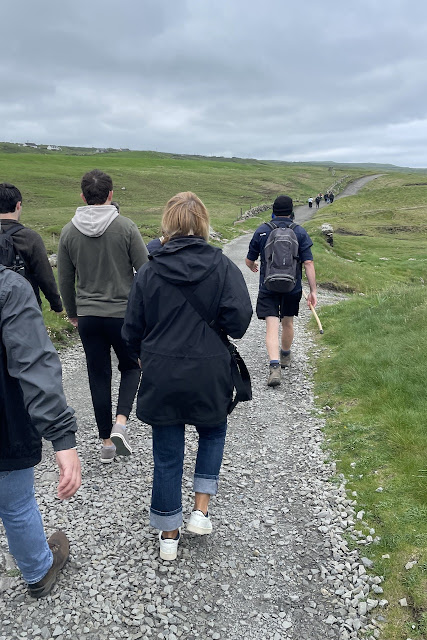
We started off from Doolin on the 10* cliff track ...... nice and wide, and carefully graded.
 We're lucky to be in Ireland in Spring with all the wildflowers out. There were "sea pinks" flowering everywhere on the walk today.
 Early on we spotted Doonagore Castle/Tower again from the track .........
 ..... and admired the wild orchids flowering right now (for only two weeks a year).
 Moving on to the 5* track ........

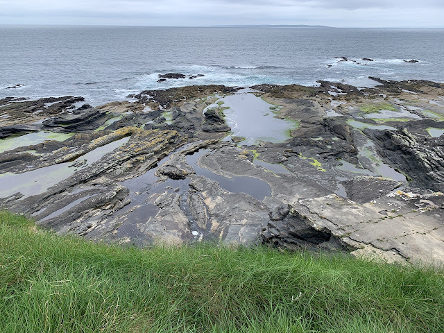
 The sandstone cliffs weather in spectacular ways over the years .......

 The local rocks were used by the Druids in ancient times to create tombs, altars and other structures for their rituals. This ancient dolmen was right near our walking track.
 This area had been an extensive quarry up until a century or so ago. The sandstone is easy to cut and was extensively used in building and as flagstones (until concrete became more widely used).

 The ruins of the old stonemasons' cottages are still evident here.
 Pat was one of the leading lights in getting this cliff track approved and up and running back in the 2000s. First of all he had to get the local farmers to agree to give up some of their land for the track and then get government support for new fencing, track laying and most importantly public liability insurance. It's still very evident however that this is farming land first and foremost.
 This was our first view of the "real" Cliffs of Moher.


 We had some great bird sightings too (but my iPhone camera lens is not good enough to show them). We were hopeful of seeing some puffins today too - but that was not to be.

 Can you see the two birds on the ledge in the middle of this pic?
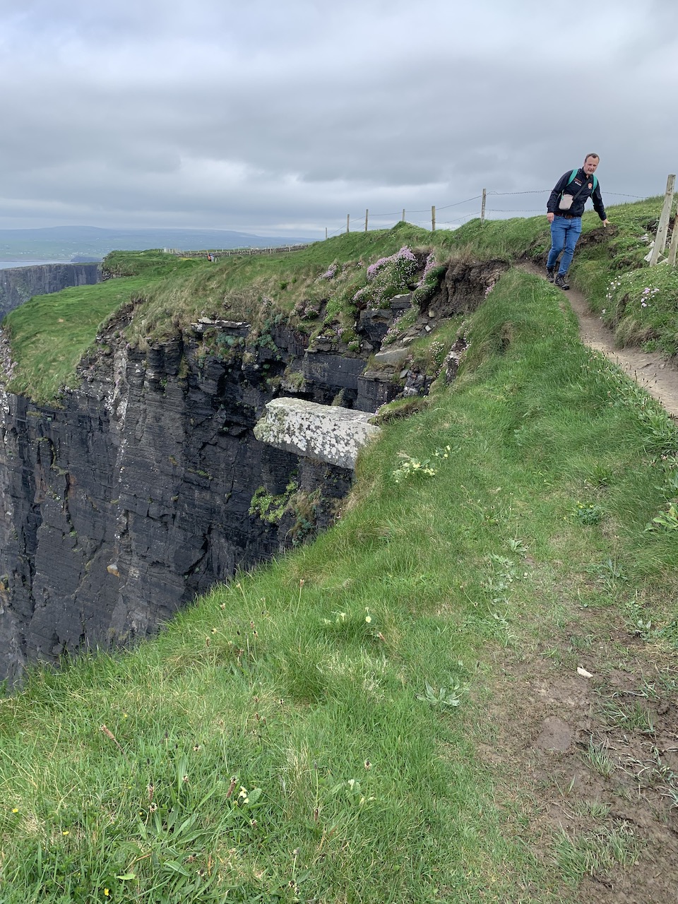
 At this point Pat took us off the main path onto the 0* track section - which freaked a few of us out...
 Here the track was about one shoe wide - very close to the cliff edge and with this sheer drop below us....
 Baby steps and keep your focus - says Pat!
 We did it!
 And worth it for this view - don't you think?


 It took us about three hours with all our story and photo stops to reach the visitor's centre which is about halfway along the total length of the Cliffs of Moher (we'd only walked the northern section).


Further on at this point there was a raging waterfall tumbling down a 200 metre (at least) cliff face - but I wasn't game to get any closer to take a picture of it!

But Farmer Pat did ............ and then scared the life out of us by telling us that 30-40 people die on these cliffs every year (including people who take their own lives). A young woman from Belgium had died on the cliffs just in the last fortnight - through slipping on the edge under wet conditions - a tragic story.


I took this picture from the viewing platform at the visitors centre which by this stage was very crowded with day trippers and selfie takers.The view of the cliffs from here was beautiful but somewhat of an anti climax (IMO) after what we'd experienced on the cliff walk. Our feet were sore but our hearts were full from having done it the way we did!
 A small bus took us back to Doolin (thankfully) and we rewarded ourselves afterwards with a long lunch and a strong coffee at The Cottage cafe near the Pier.

After lunch we took a drive north along the coast to Fanore Beach on the NW coast of the Burren.
 The backdrop to the beach is this bare limestone hill - very distinctive in the Burren landscape - but it must have made this area very hard to farm in earlier times. No doubt the proximity to sea life and bounty would have been its saviour.
 The roads in the West counties can be quite stressful to drive on. We've learnt that the road numbers starting with an L are almost life threatening and the ones starting with an R are almost as narrow. The road number back to Doolin from Fanore Beach started with an R. At one stage there was quite a hold up as two coaches travelling in opposite directions had to work out a way to inch past each other without doing any damage.
 They did manage it without any scratches! And hopefully we will too as we make our way back to Dublin tomorrow (probably on the M6) in readiness for our flight back to London on Monday. We have loved our time here in Ireland; the countryside, the history and the people are just wonderful - and we have only just scratched the surface!


No comments:
Post a Comment