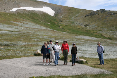
We're doing this walk in an anti-clockwise direction this time, making our way down the steep incline to the Snowy River crossing below Charlotte Pass at the start of the trek (as opposed to finishing off the 21 klm mountain trek with a killer climb up this steep slope). We'll debate whether this was an easier way to do the trek for the rest of the weekend.
It's a relatively gentle 5 klm walk through alpine meadows, past Hedley Tarn to the Blue Lake Lookout. It's very warm for this time of the year in the mountains so we are surprised to see there are still some patches of hard set snow around.
With the hardest part of the range walk ahead of us Maddie and Sophie set out well ahead of us, becoming small figures in the distance. They kept up this pace for the rest of the walk.
We're walking across some of the highest points in the Great Dividing Range here - on the rooftop of Australia.
On this part of the track we we have clear views towards the Victorian Alps in the West and the Kosciuszko National Park (NSW) to the East.
We stopped for lunch at the side of the narrow stone track high above Albina Lake - a great vantage point for admiring this remnant glacial lake.
The track is well maintained and undulates (relentlessly) across the top of the range. The uphill bits seem never ending. It's hard work at this altitude, but everyone seems to agree that the down hill bits are hardest on the knees. Luckily we can justify frequent stops to admire the views.
At this point on the track we're walking just below the summit of Mt Kosciuszko, heading towards Rawson Pass and the welcome "pit stop" below Etheridge Ridge.
There are beautifully sculpted granite outcrops all around this part of the walk.
Rob and the girls were the first to get to the multi million dollar toilet block below Etheridge Ridge. By this stage we were passing lots of walkers from the opposite direction. The Summit Walk to Mt Kosciuszko is a popular trek from Thredbo Village (using the chairlift for most of the way). We thought Maddie and Sophie looked much fitter and more enthusiastic than most of the young people we saw coming from "Thredders" for the day.
They led the way back along the 8klm gravel road that forms the Summit Walk from Charlotte Pass. Some of us were somewhat dismayed at the thought of walking another 8 klm at this stage of the day and kept a close eye on the distance counters marking each kilometre along the track.
Maddie and Sophie had some fun at this particular spot in the Snowy River - allowing us some much needed down time, while cursing the hordes of flies that seem to be a part of the Kosciuszko experience.
We took 6 and half hours today to complete this magnificent mountain walk. We ended up much more dusty, sunburnt (surprisingly), bruised and battered than the way we started, but surviving nonetheless - and feeling pretty satisfied with ourselves.


2 comments:
Hi!
Thanks so much for your informative blog on the Main Range Track. I’m still deciding whether my friends and I should do the track Clockwise (Summit walk to summit, then Main Range track down to Charlottes) or Anti-clockwise (Main Range track to summit, then summit walk to Charlottes). I’ve been hearing mixed responses.
– do you think walking back down through Main Range is easier? I’ve heard that Main Range track from Charlottes pass to summit has a lot of uphills and only one steep downhill (ie, if I went back down through this way, i will be walking mainly steep downhills and one steep uphill). Do you think the steepness in the Main Range track are tricky to walk down?
– I’ve heard that if you go up to the summit via the Main Range track, the views are a lot better than coming down. What's your verdict, having done both?
Thank you!
Best wishes,
Cindy
Post a Comment